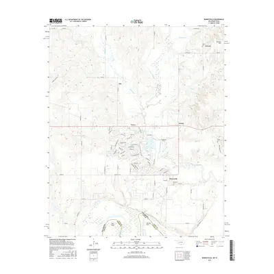
2016 Map of Burneyville
USGS Topo · Published 2016About this map
The Red River defines the southern boundary of this landscape, carving deep meanders at Warrens Bend and Tyas Bend along the Oklahoma-Texas border. Inland from the river, the terrain rises toward the Eastman Hills, where the small settlement of Eastman and the Eastman Cem are located. The map details a transition from the agricultural river bottomlands to the residential developments surrounding Turner and Dunbar, including the suburban street networks and the Falconhead Airport.
Find a feature on this map
74 named features on this map. Tap any name to fly to it.
Don’t see what you’re looking for? This feature index may not catch every label — zoom into the map to look around manually.
Map Details
Editions of this 2016 Burneyville Map
This is the sole edition of this map. No revisions or reprints were ever made.
Other maps of this area

1901 · Ardmore
USGS Topo · 1:125,000

1902 · Gainesville
USGS Topo · 1:125,000

1918 · Ardmore
USGS Topo · 1:125,000

1943 · Gainesville
USGS Topo · 1:125,000

1954 · Sherman
USGS Topo · 1:250,000

1957 · Ardmore
USGS Topo · 1:250,000

1958 · Sherman
USGS Topo · 1:250,000

1963 · Ardmore
USGS Topo · 1:250,000

1964 · Overbrook
USGS Topo · 1:24,000
1968 · Thackerville
USGS Topo · 1:24,000