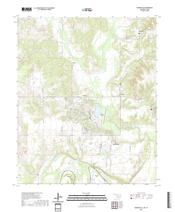
2022 Map of Burneyville
USGS Topo · Published 2022About this map
The Red River forms a serpentine border between Oklahoma and Texas along the southern edge of this Love County landscape. This region is defined by the winding course of Walnut Bayou and the high ground of the Eastman Hills, where the small settlement of Eastman is situated. The mapping shows a transition from traditional rural homesteads to the more modern layout of the Falconhead resort area near Falconhead Airport, characterized by residential streets like Chisholm Trl and Anadarko Dr. Local history is anchored by several rural burial grounds, including Burneyville Cem and the Box Cem. The river geography is particularly detailed, highlighting prominent meanders such as Tyas Bend and Warrens Bend that have shaped the agricultural and transport patterns of the borderlands for generations.
Find a feature on this map
66 named features on this map. Tap any name to fly to it.
Don’t see what you’re looking for? This feature index may not catch every label — zoom into the map to look around manually.
Map Details
Editions of this 2022 Burneyville Map
This is the sole edition of this map. No revisions or reprints were ever made.
Other maps of this area

1901 · Ardmore
USGS Topo · 1:125,000

1902 · Gainesville
USGS Topo · 1:125,000

1918 · Ardmore
USGS Topo · 1:125,000

1943 · Gainesville
USGS Topo · 1:125,000

1954 · Sherman
USGS Topo · 1:250,000

1957 · Ardmore
USGS Topo · 1:250,000

1958 · Sherman
USGS Topo · 1:250,000

1963 · Ardmore
USGS Topo · 1:250,000

1964 · Overbrook
USGS Topo · 1:24,000
1968 · Thackerville
USGS Topo · 1:24,000