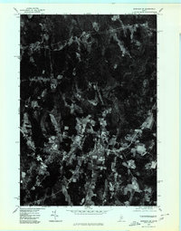
1975 Map of Burnham SW
USGS Topo · Published 1980About this map
Albion serves as the central hub of this Kennebec County landscape, where the town’s grid and surrounding farm lots are clearly visible in the orthophotographic imagery. The terrain is defined by its water systems, most notably the winding Sebasticook River in the northwest and the prominent course of Fifteenmile Stream cutting through the southern half of the quadrangle. In the southwestern corner, the settlement of South Albion sits near the shores of Lovejoy Pond, illustrating the typical Maine pattern of village development near freshwater resources. This 1975 aerial perspective provides an exact look at land use during the mid-seventies, showing the division between woodlots and active agricultural clearings that shaped the local economy before modern expansion.
Find a feature on this map
6 named features on this map. Tap any name to fly to it.
Don’t see what you’re looking for? This feature index may not catch every label — zoom into the map to look around manually.
Map Details
Editions of this 1975 Burnham SW Map
This is the sole edition of this map. No revisions or reprints were ever made.
Other maps of this area

1892 · Waterville
USGS Topo · 1:62,500

1893 · Vassalboro
USGS Topo · 1:62,500

1898 · Vassalboro
USGS Topo · 1:62,500

1916 · Liberty
USGS Topo · 1:62,500

1926 · Burnham
USGS Topo · 1:62,500

1941 · Vassalboro
USGS Topo · 1:62,500

1942 · Liberty
USGS Topo · 1:62,500

1943 · Vassalboro
USGS Topo · 1:62,500

1943 · Waterville
USGS Topo · 1:62,500

1948 · Bangor
USGS Topo · 1:250,000