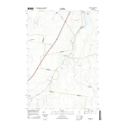
2014 Map of Burnham
USGS Topo · Published 2014About this map
The Sebasticook River Reservoir and its associated waterways form the heart of this Maine landscape at the triple junction of Somerset, Waldo, and Kennebec Counties. In the north, the river is crossed at Elweir Bridge near Pittsfield, while the village of Burnham sits downstream where Johnson Brook and Twentyfive Mile Stream converge. The rural character of the region is evident in the numerous family-named landmarks and local burial grounds, including the Weymouth Cem, Carr Cem, and Mudgett Cem. Settlement patterns follow the topography of the stream valleys, with small centers like Nash Corner, Dixon Corner, and Winnecook connected by a network of local roads such as Snakeroot Rd and Bangor Rd. This 2014 survey documents the persistence of these traditional agricultural and riverine communities within a modern transportation corridor.
Find a feature on this map
46 named features on this map. Tap any name to fly to it.
Don’t see what you’re looking for? This feature index may not catch every label — zoom into the map to look around manually.
Map Details
Editions of this 2014 Burnham Map
This is the sole edition of this map. No revisions or reprints were ever made.
Other maps of this area

1892 · Waterville
USGS Topo · 1:62,500

1913 · Skowhegan
USGS Topo · 1:62,500

1926 · Burnham
USGS Topo · 1:62,500

1930 · Pittsfield
USGS Topo · 1:48,000

1932 · Pittsfield
USGS Topo · 1:62,500

1933 · Pittsfield
USGS Topo · 1:62,500

1943 · Waterville
USGS Topo · 1:62,500

1948 · Bangor
USGS Topo · 1:250,000

1955 · Pittsfield
USGS Topo · 1:62,500

1955 · Skowhegan
USGS Topo · 1:62,500