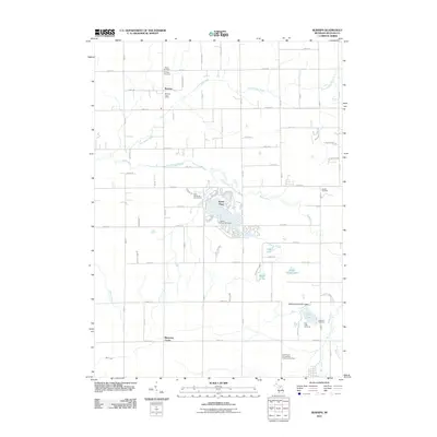
2011 Map of Burnips
USGS Topo · Published 2011About this map
Burnips and the surrounding farmland of Allegan County appear in this 2011 topographic survey, defined by a grid of agricultural roads and the winding courses of the Little Rabbit River and Rabbit River. This rural landscape is heavily marked by its community landmarks, including the Burnips Post Office and a series of burial grounds like Salem Cemetery and Tanner Cemetery. These features provide essential points of reference for local historians and genealogists tracking family lineages in the township.
Find a feature on this map
70 named features on this map. Tap any name to fly to it.
Don’t see what you’re looking for? This feature index may not catch every label — zoom into the map to look around manually.
Map Details
Editions of this 2011 Burnips Map
This is the sole edition of this map. No revisions or reprints were ever made.
Other maps of this area

1914 · Grand Rapids
USGS Topo · 1:62,500

1943 · Grand Rapids
USGS Topo · 1:62,500

1958 · Allegan
USGS Topo · 1:62,500

1958 · Grandville
USGS Topo · 1:62,500

1958 · Grand Rapids
USGS Topo · 1:250,000

1959 · Wayland
USGS Topo · 1:62,500

1961 · Grand Rapids
USGS Topo · 1:250,000

1962 · Grand Rapids
USGS Topo · 1:250,000
1967 · Cutlerville
USGS Topo · 1:24,000
1980 · Hudsonville West
USGS Topo · 1:24,000