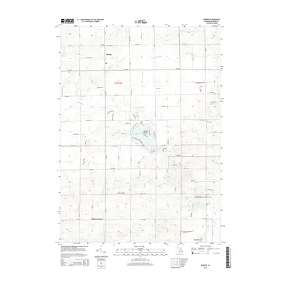
2014 Map of Burnips
USGS Topo · Published 2014About this map
Burnips and Hopkins anchor this portion of Allegan County, where the landscape is defined by the winding course of the Rabbit River and its tributary, the Little Rabbit River. The map reveals a high density of rural burial grounds, including Salem Cem, Burnips Cem, and the Saint Paul's Evangelical Lutheran Cem, which serve as vital landmarks for those tracing early families in the region. To the south, the terrain becomes increasingly varied near Monterey Center, marked by a chain of small lakes and water bodies such as Monterey Lake, Cady Lake, and Shipp Lake. The settlement pattern follows a rigid grid of numbered avenues and streets, yet the drainage patterns of Pigeon Cr and Miller Cr introduce natural variation to the otherwise orderly agricultural layout of the early 21st century.
Find a feature on this map
85 named features on this map. Tap any name to fly to it.
Don’t see what you’re looking for? This feature index may not catch every label — zoom into the map to look around manually.
Map Details
Editions of this 2014 Burnips Map
This is the sole edition of this map. No revisions or reprints were ever made.
Other maps of this area

1914 · Grand Rapids
USGS Topo · 1:62,500

1943 · Grand Rapids
USGS Topo · 1:62,500

1958 · Allegan
USGS Topo · 1:62,500

1958 · Grandville
USGS Topo · 1:62,500

1958 · Grand Rapids
USGS Topo · 1:250,000

1959 · Wayland
USGS Topo · 1:62,500

1961 · Grand Rapids
USGS Topo · 1:250,000

1962 · Grand Rapids
USGS Topo · 1:250,000
1967 · Cutlerville
USGS Topo · 1:24,000
1980 · Hudsonville West
USGS Topo · 1:24,000