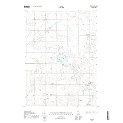
2019 Map of Burnips
USGS Topo · Published 2019About this map
Burnips and Monterey Center anchor this Allegan County landscape, where agricultural tradition meets the winding waterways of the Little Rabbit River and the Rabbit River. The map illustrates a dense network of local roads and family-named routes such as Kinney Ln and Shady Oak Ln, tracing the transition from historic farmsteads to contemporary residential clusters. Researchers will find several significant burial grounds, including the Burnips Cem, Salem Cem, and the Saint Paul's Evangelical Lutheran Cem, which reflect the area's deep-rooted community history. To the south, the village of Hopkins sits near the headwaters of Behr Cr, while the eastern portion of the sheet is dotted with recreation and leisure sites like the Beechwood Hills Camp and Shipp Lake.
Find a feature on this map
65 named features on this map. Tap any name to fly to it.
Don’t see what you’re looking for? This feature index may not catch every label — zoom into the map to look around manually.
Map Details
Editions of this 2019 Burnips Map
This is the sole edition of this map. No revisions or reprints were ever made.
Other maps of this area

1914 · Grand Rapids
USGS Topo · 1:62,500

1943 · Grand Rapids
USGS Topo · 1:62,500

1958 · Allegan
USGS Topo · 1:62,500

1958 · Grandville
USGS Topo · 1:62,500

1958 · Grand Rapids
USGS Topo · 1:250,000

1959 · Wayland
USGS Topo · 1:62,500

1961 · Grand Rapids
USGS Topo · 1:250,000

1962 · Grand Rapids
USGS Topo · 1:250,000
1967 · Cutlerville
USGS Topo · 1:24,000
1980 · Hudsonville West
USGS Topo · 1:24,000