
1955 Map of Burns
USGS Topo · Published 1964About this map
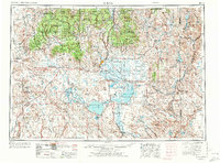
Malheur Lake and Harney Lake dominate the central basin of this mid-century high desert landscape, serving as the focal points for the Malheur National Wildlife Refuge. The twin settlements of Burns and Hines act as the regional hub, where the local timber economy is represented by a large Lumber Mill and connections to the Oregon and Northwestern railroad. To the north, the timbered slopes of the Ochoco National Forest and Malheur National Forest rise above the valley floor.
Find a feature on this map
62 named features on this map. Tap any name to fly to it.
Don’t see what you’re looking for? This feature index may not catch every label — zoom into the map to look around manually.
Map Details
Editions of this 1955 Burns Map
3 editions found
Other maps of this area

1908 · Ironside Mountain
USGS Topo · 1:125,000

1932 · Dayville
USGS Topo · 1:125,000

1936 · Dayville
USGS Topo · 1:125,000

1955 · Jordan Valley
USGS Topo · 1:250,000

1955 · Crescent
USGS Topo · 1:250,000

1955 · Klamath Falls
USGS Topo · 1:250,000

1955 · Baker
USGS Topo · 1:250,000

1955 · Bend
USGS Topo · 1:250,000

1955 · Canyon City
USGS Topo · 1:250,000

1955 · Adel
USGS Topo · 1:250,000