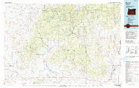
1993 Map of Burns
USGS Topo · Published 1993About this map
Burns and Hines anchor the southeastern corner of this high desert landscape, serving as the primary centers of settlement in a region defined by extensive public lands and water management. The 1993 topography reveals the complex irrigation and drainage network that supports local ranching, including the Chickahominy Reservoir and Potato Hill Reservoir. To the west and north, the terrain rises into the timbered uplands of the Ochoco National Forest and Malheur National Forest, where features like Snow Mtn and Big Mowich Mountain dominate the skyline.
Find a feature on this map
84 named features on this map. Tap any name to fly to it.
Don’t see what you’re looking for? This feature index may not catch every label — zoom into the map to look around manually.
Map Details
Editions of this 1993 Burns Map
This is the sole edition of this map. No revisions or reprints were ever made.
Other maps of this area

1932 · Dayville
USGS Topo · 1:125,000

1936 · Dayville
USGS Topo · 1:125,000

1955 · Crescent
USGS Topo · 1:250,000

1955 · Bend
USGS Topo · 1:250,000

1955 · Burns
USGS Topo · 1:250,000

1955 · Canyon City
USGS Topo · 1:250,000

1957 · Crescent
USGS Topo · 1:250,000

1957 · Bend
USGS Topo · 1:250,000

1958 · Crescent
USGS Topo · 1:250,000

1958 · Burns
USGS Topo · 1:250,000