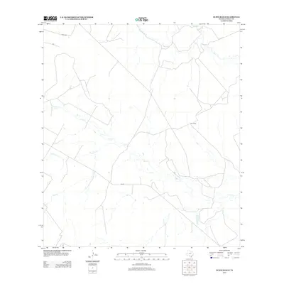
2013 Map of Burns Ranch
USGS Topo · Published 2013About this map
The Frio River flows through the northern reaches of this La Salle County landscape, where the coastal plain of South Texas is defined by its seasonal drainage network and large-scale ranching operations. The map is centered on the expansive Burns Ranch, illustrating the typical land use patterns of the region where sprawling properties are connected by a mix of state and local routes such as FM 469 and Vegara Rd. The terrain is etched by numerous watercourses, including Cibolo Cr, Lewis Cr, and Slaughter Cr, which snake through the brush country. These intermittent creeks and branches, like Martin Br, provide a clear picture of the natural watershed that has historically dictated the placement of roads and homesteads in this part of the Brush Country south of the Nueces.
Find a feature on this map
9 named features on this map. Tap any name to fly to it.
Don’t see what you’re looking for? This feature index may not catch every label — zoom into the map to look around manually.
Map Details
Editions of this 2013 Burns Ranch Map
This is the sole edition of this map. No revisions or reprints were ever made.
Other maps of this area

1929 · Cotulla
USGS Topo · 1:125,000

1940 · Cotulla
USGS Topo · 1:62,500

1942 · Fowlerton
USGS Topo · 1:62,500

1942 · Dilley
USGS Topo · 1:62,500

1953 · Crystal City
USGS Topo · 1:250,000

1955 · Crystal City
USGS Topo · 1:250,000

1956 · Hindes
USGS Topo · 1:62,500

1956 · Fowlerton
USGS Topo · 1:62,500

1961 · Crystal City
USGS Topo · 1:250,000

1968 · Crystal City
USGS Topo · 1:250,000