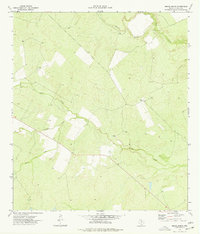
1974 Map of Burns Ranch
USGS Topo · Published 1977About this map
The Frio River flows through the northeast corner of this 1974 survey, anchoring a landscape defined by seasonal watercourses and sprawling ranch lands. At the heart of the terrain lies Burns Ranch, a central landmark surrounded by a network of drainage systems including Cibolo Creek, Slaughter Creek, and Lewis Creek. These creeks reveal the natural hydrology of the South Texas brush country, where intermittent streams dictate the placement of ranch infrastructure and grazing patterns.
Find a feature on this map
8 named features on this map. Tap any name to fly to it.
Don’t see what you’re looking for? This feature index may not catch every label — zoom into the map to look around manually.
Map Details
Editions of this 1974 Burns Ranch Map
This is the sole edition of this map. No revisions or reprints were ever made.
Other maps of this area

1929 · Cotulla
USGS Topo · 1:125,000

1940 · Cotulla
USGS Topo · 1:62,500

1942 · Fowlerton
USGS Topo · 1:62,500

1942 · Dilley
USGS Topo · 1:62,500

1953 · Crystal City
USGS Topo · 1:250,000

1955 · Crystal City
USGS Topo · 1:250,000

1956 · Hindes
USGS Topo · 1:62,500

1956 · Fowlerton
USGS Topo · 1:62,500

1961 · Crystal City
USGS Topo · 1:250,000

1968 · Crystal City
USGS Topo · 1:250,000