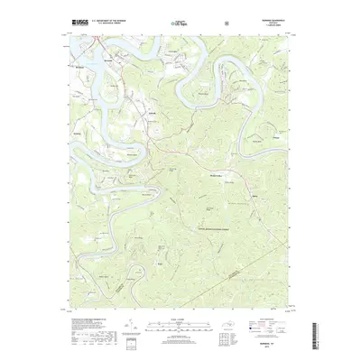
2019 Map of Burnside
USGS Topo · Published 2019About this map
The Big South Fork Cumberland River joins the main body of Lake Cumberland near Burnside, creating a landscape defined by deep water bends and steep ridges. This 2019 survey captures the modern geography of southeastern Pulaski County, where the Cno & TP RR runs north-south through the settlements of Tateville, Sloans Valley, and Alpine. The terrain is characterized by intricate hollows and knobs, such as Seed Tick Knob and Pumpkin Hollow, which have historically isolated small communities.
Find a feature on this map
71 named features on this map. Tap any name to fly to it.
Don’t see what you’re looking for? This feature index may not catch every label — zoom into the map to look around manually.
Map Details
Editions of this 2019 Burnside Map
This is the sole edition of this map. No revisions or reprints were ever made.
Other maps of this area

1890 · Williamsburg
USGS Topo · 1:125,000

1893 · London
USGS Topo · 1:125,000

1894 · Williamsburg
USGS Topo · 1:125,000

1897 · London
USGS Topo · 1:125,000

1932 · Burnside
USGS Topo · 1:62,500

1935 · Somerset
USGS Topo · 1:62,500

1952 · Hail
USGS Topo · 1:24,000

1952 · Wiborg
USGS Topo · 1:24,000

1952 · Dykes
USGS Topo · 1:24,000

1953 · Frazer
USGS Topo · 1:24,000