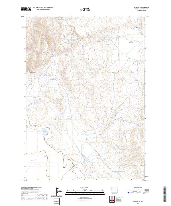
2023 Map of Burnt Flat
USGS Topo · Published 2023About this map
Burnt Flat and Little Mud Flat characterize this high-desert basin in eastern Oregon, where a sophisticated system of water management allows for seasonal ranching. The landscape is defined by a network of catchments and natural drainages, including Mud Creek and Cedar Creek, which feed numerous named reservoirs such as Prince Albert Reservoir, Dowell Reservoir, and Buckskin Reservoir. These features, often named for early settlers or ranching families, indicate a history of land use focused on livestock in a territory where water is the primary currency.
Find a feature on this map
33 named features on this map. Tap any name to fly to it.
Don’t see what you’re looking for? This feature index may not catch every label — zoom into the map to look around manually.
Map Details
Editions of this 2023 Burnt Flat Map
This is the sole edition of this map. No revisions or reprints were ever made.
Other maps of this area

1955 · Boise
USGS Topo · 1:250,000

1958 · Boise
USGS Topo · 1:250,000

1962 · Boise
USGS Topo · 1:250,000

1972 · Cedar Mountain
USGS Topo · 1:24,000

1972 · Burnt Flat
USGS Topo · 1:24,000

1972 · Crowley
USGS Topo · 1:24,000
1972 · Sacramento Butte
USGS Topo · 1:24,000
1972 · Mustang Butte
USGS Topo · 1:24,000
1972 · Rinehart Canyon
USGS Topo · 1:24,000

1972 · Copeland Reservoirs
USGS Topo · 1:24,000