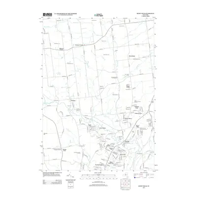
2013 Map of Burnt Hills
USGS Topo · Published 2013About this map
The agricultural and residential landscape of Saratoga County is defined here by a series of long-standing family farms and orchards, such as Knight Orchard of Saratoga County and Lake Ridge Farms. This 2013 survey illustrates the dense network of small settlements and neighborhood clusters that characterize the region, including Harmony Corners, High Mills, and Glenville Center. The map is particularly useful for genealogical research, documenting numerous burial grounds such as the Glenville Center Methodist Episcopal Church Cem and the Burnt Hills Calvary Episcopal Church Cem.
Find a feature on this map
171 named features on this map. Tap any name to fly to it.
Don’t see what you’re looking for? This feature index may not catch every label — zoom into the map to look around manually.
Map Details
Editions of this 2013 Burnt Hills Map
This is the sole edition of this map. No revisions or reprints were ever made.
Other maps of this area

1893 · Schenectady
USGS Topo · 1:62,500

1895 · Schenectady
USGS Topo · 1:62,500

1895 · Amsterdam
USGS Topo · 1:62,500

1898 · Schenectady
USGS Topo · 1:62,500

1899 · Broadalbin
USGS Topo · 1:62,500

1902 · Broadalbin
USGS Topo · 1:62,500

1902 · Saratoga
USGS Topo · 1:62,500

1930 · Schenectady
USGS Topo · 1:62,500

1931 · Amsterdam
USGS Topo · 1:62,500

1934 · Saratoga Springs
USGS Topo · 1:24,000