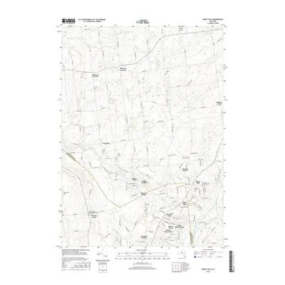
2016 Map of Burnt Hills
USGS Topo · Published 2016About this map
Burnt Hills and East Glenville anchor the southeastern portion of this landscape, showing the dense residential patterns that define the suburban character of the late 20th and early 21st centuries. The terrain transitions from these populated neighborhoods to the expansive agricultural and wooded lands around Charlton and Harmony Corners. Small, scattered communities like Holbrook Corners and High Mills are linked by a network of rural roads such as Sweetman Rd and Co Rd 52.
Find a feature on this map
130 named features on this map. Tap any name to fly to it.
Don’t see what you’re looking for? This feature index may not catch every label — zoom into the map to look around manually.
Map Details
Editions of this 2016 Burnt Hills Map
This is the sole edition of this map. No revisions or reprints were ever made.
Other maps of this area

1893 · Schenectady
USGS Topo · 1:62,500

1895 · Schenectady
USGS Topo · 1:62,500

1895 · Amsterdam
USGS Topo · 1:62,500

1898 · Schenectady
USGS Topo · 1:62,500

1899 · Broadalbin
USGS Topo · 1:62,500

1902 · Broadalbin
USGS Topo · 1:62,500

1902 · Saratoga
USGS Topo · 1:62,500

1930 · Schenectady
USGS Topo · 1:62,500

1931 · Amsterdam
USGS Topo · 1:62,500

1934 · Saratoga Springs
USGS Topo · 1:24,000