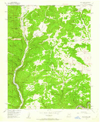
1954 Map of Burnt Mesa
USGS Topo · Published 1963About this map
Los Pinos River carves a deep valley along the western edge of this 1954 survey, defining the rugged geography of the San Juan Basin borderlands. The map reveals a landscape of high mesas and numerous drainage systems, such as Wool Canyon and Cottonwood Canyon, punctuated by early energy development. The presence of several Gas Wells and a prominent Pipeline indicates the region's mid-century industrial shift.
Find a feature on this map
35 named features on this map. Tap any name to fly to it.
Don’t see what you’re looking for? This feature index may not catch every label — zoom into the map to look around manually.
Map Details
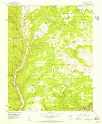
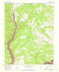
Editions of this 1954 Burnt Mesa Map
3 editions found
Other maps of this area

1889 · Largo
USGS Topo · 1:250,000

1895 · Largo
USGS Topo · 1:250,000

1908 · Ignacio
USGS Topo · 1:125,000

1924 · Ignacio
USGS Topo · 1:125,000

1924 · Pagosa Springs
USGS Topo · 1:125,000

1927 · Pagosa Springs
USGS Topo · 1:125,000

1945 · Durango
USGS Topo · 1:250,000

1953 · Durango
USGS Topo · 1:250,000

1954 · Durango
USGS Topo · 1:250,000
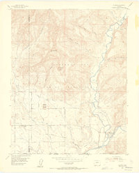
1954 · Allison
USGS Topo · 1:24,000