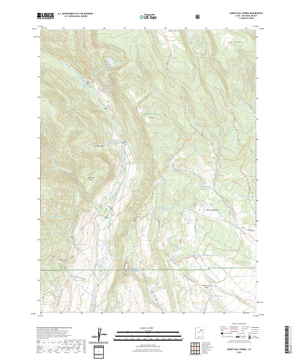
2023 Map of Burnt Mill Spring
USGS Topo · Published 2023About this map
The Ashley National Forest and High Uintas Wilderness converge here, creating a landscape defined by complex water management and high-elevation terrain. Central to the area is the Yellowstone Power Diversion Reservoir on the Yellowstone River, which indicates early 21st-century hydroelectric or irrigation infrastructure. The geography is marked by numerous springs and small-scale reservoirs, including Burnt Mill Spring and Mud Spring Reservoir Number 3, supporting the high-plateau environment of Seventyseven Flat. Movement through the region relies on a network of traditional paths and forest roads like the Yellowstone Trl and High Line Rd. These routes connect remote landmarks such as Flat Top Mtn and the distinct geological formation of the Yellow Ledges, reflecting a modern era of forest management and wilderness preservation.
Find a feature on this map
48 named features on this map. Tap any name to fly to it.
Don’t see what you’re looking for? This feature index may not catch every label — zoom into the map to look around manually.
Map Details
Editions of this 2023 Burnt Mill Spring Map
This is the sole edition of this map. No revisions or reprints were ever made.
Other maps of this area

1885 · Uinta
USGS Topo · 1:250,000

1905 · Gilbert Peak
USGS Topo · 1:125,000

1906 · Gilbert Peak
USGS Topo · 1:125,000

1939 · Duchesne
USGS Topo · 1:125,000

1954 · Salt Lake City
USGS Topo · 1:250,000

1958 · Salt Lake City
USGS Topo · 1:250,000

1960 · Salt Lake City
USGS Topo · 1:250,000

1965 · Mount Emmons
USGS Topo · 1:24,000
1965 · Heller Lake
USGS Topo · 1:24,000
1965 · Mountain Home
USGS Topo · 1:24,000