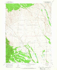
1965 Map of Mountain Home
USGS Topo · Published 1967About this map
Mountain Home sits at the southeastern edge of this mid-1960s landscape, serving as a localized hub within the expansive Uintah and Ouray Indian Reservation. The geography is defined by a sophisticated network of irrigation infrastructure, including the Farnsworth Canal, Reservation Canal, and various laterals designed to manage water across the arid high-desert terrain. These man-made channels cut across the natural drainage of Pigeon Water Creek and Big Hollow, illustrating the intense effort to reclaim and cultivate Towanta Flat. To the west, the terrain rises toward prominent landmarks like Bald Knoll and Twin Knolls, while the Lake Fork River carves a green corridor through the northeast. This survey provides an essential look at the intersection of tribal land management and the technical water engineering required for settlement in Duchesne County.
Find a feature on this map
20 named features on this map. Tap any name to fly to it.
Don’t see what you’re looking for? This feature index may not catch every label — zoom into the map to look around manually.
Map Details
Editions of this 1965 Mountain Home Map
2 editions found
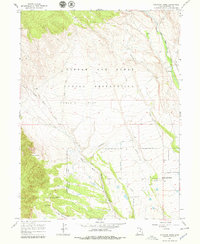
Other maps of this area

1885 · Uinta
USGS Topo · 1:250,000

1901 · Hayden Peak
USGS Topo · 1:125,000

1903 · Hayden Peak
USGS Topo · 1:125,000

1905 · Gilbert Peak
USGS Topo · 1:125,000

1906 · Gilbert Peak
USGS Topo · 1:125,000

1939 · Duchesne
USGS Topo · 1:125,000

1954 · Salt Lake City
USGS Topo · 1:250,000

1958 · Salt Lake City
USGS Topo · 1:250,000

1960 · Salt Lake City
USGS Topo · 1:250,000

1962 · Blacktail Mtn
USGS Topo · 1:24,000