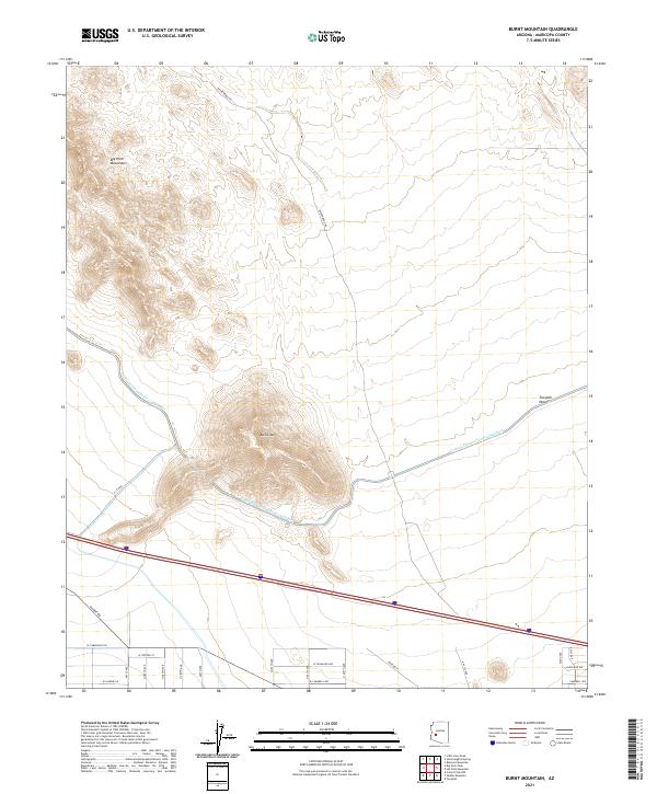
2021 Map of Burnt Mountain
USGS Topo · Published 2021About this map
Burnt Mtn rises as a central landmark in this arid landscape of western Maricopa County, anchoring a terrain defined by desert expanses and modern infrastructure. The Central Arizona Project Aqueduct cuts a distinctive path across the quadrangle, illustrating the massive scale of water management required to sustain this region. To the north, the foothills of the Big Horn Mountains provide a sharp contrast to the lower reaches of the Tonopah Desert. The map reveals a transitioning landscape where traditional routes like Wickenburg Rd and Salome Rd meet an emerging residential grid. In the southern sections, the formalization of suburban planning is evident through named thoroughfares such as W Highland Ave and W Campbell Ave, marking the steady encroachment of the metropolitan footprint into the desert.
Find a feature on this map
30 named features on this map. Tap any name to fly to it.
Don’t see what you’re looking for? This feature index may not catch every label — zoom into the map to look around manually.
Map Details
Editions of this 2021 Burnt Mountain Map
This is the sole edition of this map. No revisions or reprints were ever made.
Other maps of this area

1942 · Vicksburg
USGS Topo · 1:250,000

1954 · Phoenix
USGS Topo · 1:250,000

1957 · Phoenix
USGS Topo · 1:250,000

1958 · Phoenix
USGS Topo · 1:250,000

1960 · Phoenix
USGS Topo · 1:250,000

1961 · Big Horn Mts
USGS Topo · 1:62,500

1962 · Belmont Mts
USGS Topo · 1:62,500

1962 · Cortez Peak
USGS Topo · 1:62,500

1962 · Arlington
USGS Topo · 1:62,500

1969 · Phoenix
USGS Topo · 1:250,000