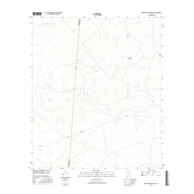
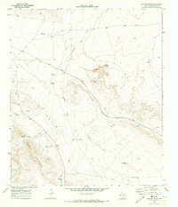
2016 Map of Burnt Spring Hills SE
USGS Topo · Published 2016About this map
The Culberson Co Reeves Co boundary line bisects this arid West Texas landscape, a region defined by its vital water management infrastructure for ranching and livestock. Scattered across the terrain are numerous artificial catchments such as White Side Tank, North Rock Tank, and Bull Tank, which serve as the primary landmarks in an area otherwise characterized by ephemeral watercourses. Natural drainage patterns are recorded through seasonal features like Hart Draw and Herds Pass Draw, which navigate the subtle elevation changes of the Burnt Spring Hills. Transportation in the mid-2010s was facilitated by a network of rural routes including Toyah Rd and Co Rd 225, providing access to this remote portion of the Trans-Pecos. The map highlights the intersection of physical geography and man-made modifications in a desert environment where every named tank, like Frijol Tank, signifies a specific point of human activity and survival.
Find a feature on this map
12 named features on this map. Tap any name to fly to it.
Don’t see what you’re looking for? This feature index may not catch every label — zoom into the map to look around manually.
Map Details
Editions of this 2016 Burnt Spring Hills SE Map
This is the sole edition of this map. No revisions or reprints were ever made.
Other maps of this area

1921 · Toyah
USGS Topo · 1:125,000

1928 · Kent
USGS Topo · 1:125,000

1954 · Van Horn
USGS Topo · 1:250,000

1954 · Pecos
USGS Topo · 1:250,000

1957 · Pecos
USGS Topo · 1:250,000

1958 · Van Horn
USGS Topo · 1:250,000
1970 · San Martine
USGS Topo · 1:24,000
1970 · Gozar
USGS Topo · 1:24,000
1970 · Toyah SW
USGS Topo · 1:24,000
1970 · Iron Mountain
USGS Topo · 1:24,000