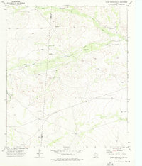
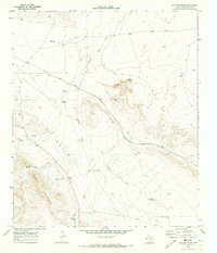
1973 Map of Burnt Spring Hills SE
USGS Topo · Published 1976About this map
The Culberson and Reeves County line bisects this remote West Texas landscape, where the scarcity of water dictated the pattern of ranching and land use in the early 1970s. The terrain is defined by the ephemeral courses of Hart Draw and Salt Draw, which are complemented by a network of engineered water features essential for livestock survival. The Hart Ranch serves as a primary hub of human activity, supported by scattered improvements such as White Side Tank, Double Wells, and the Frijol Tank.
Find a feature on this map
24 named features on this map. Tap any name to fly to it.
Don’t see what you’re looking for? This feature index may not catch every label — zoom into the map to look around manually.
Map Details
Editions of this 1973 Burnt Spring Hills SE Map
This is the sole edition of this map. No revisions or reprints were ever made.
Other maps of this area

1921 · Toyah
USGS Topo · 1:125,000

1928 · Kent
USGS Topo · 1:125,000

1954 · Van Horn
USGS Topo · 1:250,000

1954 · Pecos
USGS Topo · 1:250,000

1957 · Pecos
USGS Topo · 1:250,000

1958 · Van Horn
USGS Topo · 1:250,000
1970 · San Martine
USGS Topo · 1:24,000
1970 · Gozar
USGS Topo · 1:24,000
1970 · Toyah SW
USGS Topo · 1:24,000
1970 · Iron Mountain
USGS Topo · 1:24,000