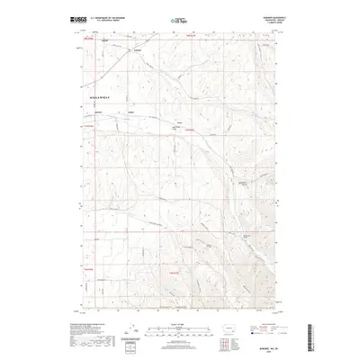
2020 Map of Buroker
USGS Topo · Published 2020About this map
The Walla Walla Valley serves as the backdrop for this study of the agricultural and rural landscape northeast of the city. Small named settlements like Sapolil, Buroker, and Kibler are linked by a complex network of county roads that trace the natural contours of the undulating terrain. The drainage systems of Mill Cr and its tributaries, including Titus Cr and Blue Cr, define the movement through the valley, while higher elevations to the southeast are marked by Nightingale Canyon and Little Bear Ridge Rd. Notable landmarks such as Wickersham Bridge and Darcy's Air Strip highlight the varied uses of the land. This survey illustrates the persistent rural character of the region, where family-named roads like Smith Rd and Mc Kay Grade Rd indicate a deep-rooted history of settlement and land ownership in Walla Walla County.
Find a feature on this map
53 named features on this map. Tap any name to fly to it.
Don’t see what you’re looking for? This feature index may not catch every label — zoom into the map to look around manually.
Map Details
Editions of this 2020 Buroker Map
This is the sole edition of this map. No revisions or reprints were ever made.
Other maps of this area

1919 · Walla Walla
USGS Topo · 1:125,000

1921 · Walla Walla
USGS Topo · 1:125,000

1953 · Pendleton
USGS Topo · 1:250,000

1953 · Walla Walla
USGS Topo · 1:250,000

1956 · Pendleton
USGS Topo · 1:250,000

1958 · Walla Walla
USGS Topo · 1:250,000

1963 · Big Meadows
USGS Topo · 1:24,000

1963 · Peterson Ridge
USGS Topo · 1:24,000

1964 · Bowlus Hill
USGS Topo · 1:24,000

1966 · Dixie
USGS Topo · 1:24,000