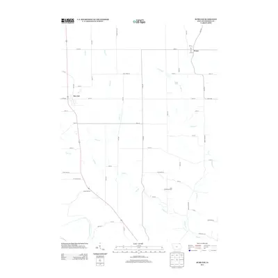
2013 Map of Burr Oak
USGS Topo · Published 2013About this map
Burr Oak and Hesper serve as the primary hubs for this agricultural landscape in northeastern Iowa. The area is defined by the winding course of Canoe Cr and its northern branch, N Canoe Cr, which carve through the terrain alongside smaller tributaries like Silver Cr and Silent Brook. A notable institutional landmark is the Luther College Observatory, situated on a ridge overlooking the valley. To the southwest, the Upper Iowa River cuts across the corner of the map, anchoring a network of rural routes such as Co Hwy-A14 and N Winn Rd. The settlement pattern reflects the enduring grid of Winneshiek County, where family farms are connected by roads like Middle Hesper Rd and Fox Hollow Rd.
Find a feature on this map
50 named features on this map. Tap any name to fly to it.
Don’t see what you’re looking for? This feature index may not catch every label — zoom into the map to look around manually.
Map Details
Editions of this 2013 Burr Oak Map
This is the sole edition of this map. No revisions or reprints were ever made.
Other maps of this area

1906 · Decorah
USGS Topo · 1:125,000

1958 · La Crosse
USGS Topo · 1:250,000

1961 · La Crosse
USGS Topo · 1:250,000

1965 · La Crosse
USGS Topo · 1:250,000

1965 · Mabel
USGS Topo · 1:24,000

1965 · Spring Grove
USGS Topo · 1:24,000

1965 · Canton
USGS Topo · 1:24,000

1975 · Decorah 1 NW
USGS Topo · 1:24,000

1975 · Decorah 2 NW
USGS Topo · 1:24,000

1975 · Decorah 1 SW
USGS Topo · 1:24,000