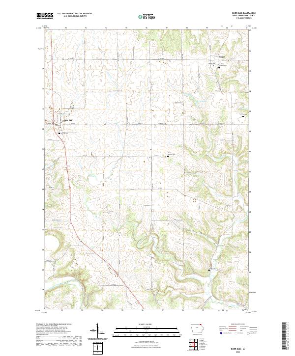
2022 Map of Burr Oak
USGS Topo · Published 2022About this map
Burr Oak and Hesper serve as the primary nodes of settlement in this northern Winneshiek County landscape, situated near the Minnesota border. The terrain is defined by a dense network of seasonal and permanent watercourses, including the Upper Iowa River in the southwest and the winding paths of Canoe Cr and Silver Cr. This area reflects a long-established rural cemetery pattern, with numerous small burial grounds such as Wilson - Smalley Cem and Salveson Cem tucked away on section lines and farm roads. The convergence of N Canoe Cr and S Bear Cr in the northeast near Hesper suggests an environment shaped by these diverse drainages. Many local roads, such as Silent Brook Rd and Hitching Post Rd, follow the natural contours of the stream valleys and ridge tops, preserving a traditional Midwestern agricultural layout that has persisted for generations.
Find a feature on this map
55 named features on this map. Tap any name to fly to it.
Don’t see what you’re looking for? This feature index may not catch every label — zoom into the map to look around manually.
Map Details
Editions of this 2022 Burr Oak Map
This is the sole edition of this map. No revisions or reprints were ever made.
Other maps of this area

1906 · Decorah
USGS Topo · 1:125,000

1958 · La Crosse
USGS Topo · 1:250,000

1961 · La Crosse
USGS Topo · 1:250,000

1965 · La Crosse
USGS Topo · 1:250,000

1965 · Mabel
USGS Topo · 1:24,000

1965 · Spring Grove
USGS Topo · 1:24,000

1965 · Canton
USGS Topo · 1:24,000

1975 · Decorah 1 NW
USGS Topo · 1:24,000

1975 · Decorah 2 NW
USGS Topo · 1:24,000

1975 · Decorah 1 SW
USGS Topo · 1:24,000