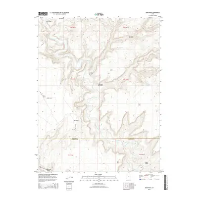
2014 Map of Burr Point
USGS Topo · Published 2014About this map
Burr Point and the remote settlement of Gilex overlook a deeply carved landscape along the border of Wayne and Garfield Counties. The serpentine path of the Dirty Devil River dominates the topography, winding through vertical-walled features like Twin Corral Box Canyon and Sams Mesa Box Canyon. These geological formations represent the extreme high desert environment, where flat mesas such as Sams Mesa and Bert Mesa provide a sharp contrast to the surrounding depressions of Adobe Swale and the Burr Desert. Primitive travel routes, including Dell Seep Rd and Poison Springs Wash Rd, suggest the sparse human footprint in this area. A single water source, Sams Mesa Spring, is marked on the eastern plateau, illustrating the limited resources available in this high-altitude terrain. The map captures the complex drainage systems of Happy Canyon and Poison Spring Canyon as they contribute to the regional watershed of the Colorado River basin.
Find a feature on this map
26 named features on this map. Tap any name to fly to it.
Don’t see what you’re looking for? This feature index may not catch every label — zoom into the map to look around manually.
Map Details
Editions of this 2014 Burr Point Map
This is the sole edition of this map. No revisions or reprints were ever made.
Other maps of this area

1885 · San Rafael
USGS Topo · 1:250,000

1952 · Orange Cliffs 3 SW
USGS Topo · 1:24,000

1952 · Bull Mountain
USGS Topo · 1:62,500

1953 · Orange Cliffs 3 SE
USGS Topo · 1:24,000

1953 · Orange Cliffs 3 NE
USGS Topo · 1:24,000

1953 · Orange Cliffs 3 NW
USGS Topo · 1:24,000

1953 · Fiddler Butte
USGS Topo · 1:62,500

1956 · Salina
USGS Topo · 1:250,000

1960 · Salina
USGS Topo · 1:250,000

1962 · Salina
USGS Topo · 1:250,000