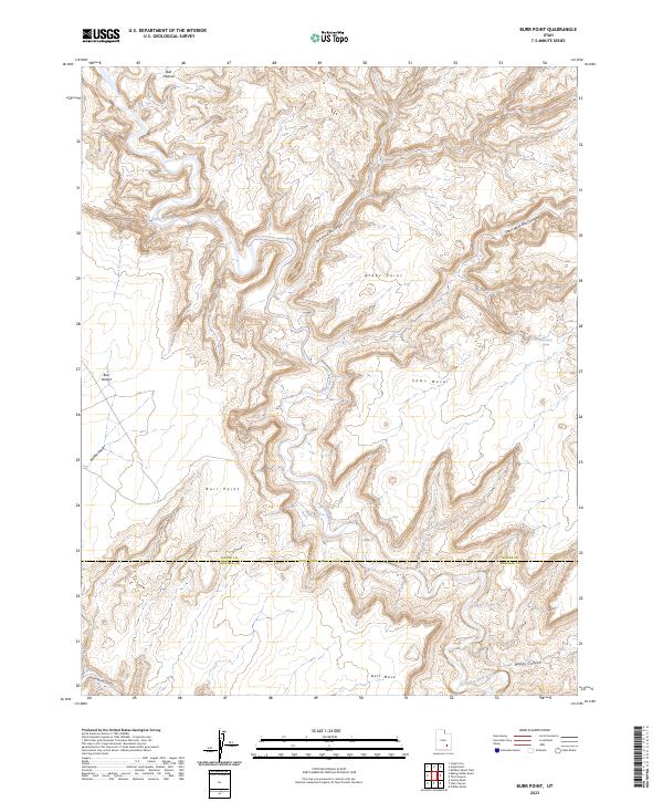
2023 Map of Burr Point
USGS Topo · Published 2023About this map
The Dirty Devil River carves a complex course through this high desert landscape, defining the boundary-heavy terrain where Wayne County meets Garfield County. This region is characterized by elevated plateaus and deep incisions, with prominent landforms like Sams Mesa and Bert Mesa towering over the surrounding drainages. The map reveals a network of sheltered canyons, including Twin Corral Box Canyon and Sams Mesa Box Canyon, which illustrate the erosion patterns typical of this part of Utah.
Find a feature on this map
14 named features on this map. Tap any name to fly to it.
Don’t see what you’re looking for? This feature index may not catch every label — zoom into the map to look around manually.
Map Details
Editions of this 2023 Burr Point Map
This is the sole edition of this map. No revisions or reprints were ever made.
Other maps of this area

1885 · San Rafael
USGS Topo · 1:250,000

1952 · Orange Cliffs 3 SW
USGS Topo · 1:24,000

1952 · Bull Mountain
USGS Topo · 1:62,500

1953 · Orange Cliffs 3 SE
USGS Topo · 1:24,000

1953 · Orange Cliffs 3 NE
USGS Topo · 1:24,000

1953 · Orange Cliffs 3 NW
USGS Topo · 1:24,000

1953 · Fiddler Butte
USGS Topo · 1:62,500

1956 · Salina
USGS Topo · 1:250,000

1960 · Salina
USGS Topo · 1:250,000

1962 · Salina
USGS Topo · 1:250,000