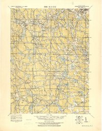
1921 Map of Burrillville
USGS Topo · Published 1921About this map
Industrial mill villages and scattered hill farms define the northern Rhode Island landscape in this tactical survey compiled by the Corps of Engineers. Settlements such as Harrisville, Pascoag, and Slatersville are shown at a time when their textile economies were deeply integrated with the region’s complex water network. The map reveals the extensive reliance on reservoirs like Wilson Reservoir and Pascoag Reservoir to power local industry, while smaller hamlets like Mohegan and Nasonville line the Clear River.
Find a feature on this map
126 named features on this map. Tap any name to fly to it.
Don’t see what you’re looking for? This feature index may not catch every label — zoom into the map to look around manually.
Map Details
Editions of this 1921 Burrillville Map
This is the sole edition of this map. No revisions or reprints were ever made.
Other maps of this area

1886 · Blackstone
USGS Topo · 1:62,500

1887 · Franklin
USGS Topo · 1:62,500

1887 · Providence
USGS Topo · 1:62,500

1889 · Providence
USGS Topo · 1:62,500

1889 · Blackstone
USGS Topo · 1:62,500

1889 · Webster
USGS Topo · 1:62,500

1889 · Franklin
USGS Topo · 1:62,500

1889 · Putnam
USGS Topo · 1:62,500

1889 · Burrillville
USGS Topo · 1:62,500

1889 · Moosup
USGS Topo · 1:62,500