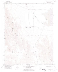
1973 Map of Burro Basin
USGS Topo · Published 1976About this map
Desert National Wildlife Range overlaps with the military restricted airspace of the Nellis Air Force Range in this 1973 survey of Lincoln County. The landscape is dominated by the high-elevation Burro Basin and the stark transition into the Desert Valley (Depression). The presence of the Chuckwalla Guzzler indicates the managed water resources essential for wildlife in this arid environment.
Find a feature on this map
16 named features on this map. Tap any name to fly to it.
Don’t see what you’re looking for? This feature index may not catch every label — zoom into the map to look around manually.
Map Details
Editions of this 1973 Burro Basin Map
This is the sole edition of this map. No revisions or reprints were ever made.
Other maps of this area

1907 · Las Vegas
USGS Topo · 1:250,000

1908 · Las Vegas
USGS Topo · 1:250,000

1945 · Sheep Range
USGS Topo · 1:125,000

1945 · Alamo
USGS Topo · 1:125,000

1954 · Caliente
USGS Topo · 1:250,000

1954 · Las Vegas
USGS Topo · 1:250,000

1957 · Las Vegas
USGS Topo · 1:250,000

1959 · Caliente
USGS Topo · 1:250,000

1959 · Las Vegas
USGS Topo · 1:250,000

1962 · Las Vegas
USGS Topo · 1:250,000