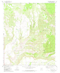
1980 Map of Burro Mesa
USGS Topo · Published 1980About this map
The expansive northern Arizona landscape of the Luis Maria Baca Float No 5 grant and Burro Mesa is defined by a complex network of high plateaus and deep drainage systems. This 1980 survey reveals the infrastructure of remote ranching life, where water management is critical, evidenced by dozens of named catchments like Lovelace Tank, Juan Tank, and McElheny Tank. The drainage of Hellzapoppin Canyon and Spencer Creek carve through the terrain, illustrating the geological forces that shaped this part of Yavapai County.
Find a feature on this map
45 named features on this map. Tap any name to fly to it.
Don’t see what you’re looking for? This feature index may not catch every label — zoom into the map to look around manually.
Map Details
Editions of this 1980 Burro Mesa Map
2 editions found
Other maps of this area

1923 · Signal
USGS Topo · 1:250,000

1942 · Signal
USGS Topo · 1:250,000

1945 · Bagdad
USGS Topo · 1:62,500

1948 · Bagdad
USGS Topo · 1:62,500

1950 · Prescott
USGS Topo · 1:250,000

1954 · Prescott
USGS Topo · 1:250,000

1958 · Prescott
USGS Topo · 1:250,000

1959 · Prescott
USGS Topo · 1:250,000

1960 · Prescott
USGS Topo · 1:250,000

1965 · Prescott
USGS Topo · 1:250,000