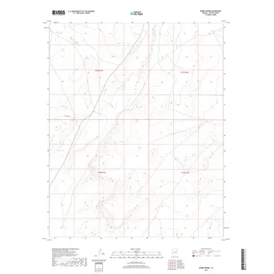
2018 Map of Burro Spring
USGS Topo · Published 2018About this map
Burro Spring and Shonto Spring serve as vital water sources in this high-desert portion of Navajo County, defining the settlement and travel patterns of the landscape. The terrain is structured by the passage of Indian Rte 58, which traverses the western half of the quadrangle. This 2018 survey reveals a sparse but functionally organized landscape within the township and range system, specifically covering parts of t27n r15e, t27n r16e, t26n r15e, and t26n r16e. The presence of these named springs suggests their enduring importance for livestock and local use in a region where reliable water is the primary factor for navigation and land utility.
Find a feature on this map
7 named features on this map. Tap any name to fly to it.
Don’t see what you’re looking for? This feature index may not catch every label — zoom into the map to look around manually.
Map Details
Editions of this 2018 Burro Spring Map
This is the sole edition of this map. No revisions or reprints were ever made.
Other maps of this area

1883 · Tusayan
USGS Topo · 1:250,000

1886 · Tusayan
USGS Topo · 1:250,000

1947 · Flagstaff
USGS Topo · 1:250,000

1954 · Flagstaff
USGS Topo · 1:250,000

1958 · Flagstaff
USGS Topo · 1:250,000

1960 · Flagstaff
USGS Topo · 1:250,000

1962 · Flagstaff
USGS Topo · 1:250,000

1966 · Oraibi
USGS Topo · 1:62,500

1966 · Tovar Mesa
USGS Topo · 1:62,500
1967 · Garces Mesas SE
USGS Topo · 1:24,000