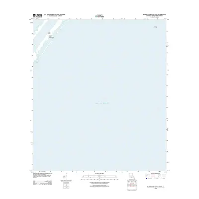
2012 Map of Burrwood Bayou East
USGS Topo · Published 2012About this map
Industrial infrastructure meets the vast maritime reaches of the Mississippi River Delta on this 2012 survey of the Louisiana coast. The geography is dominated by the SW Pass, a critical shipping artery where the river enters the Gulf of Mexico. This particular section of Plaquemines Parish reflects a landscape defined by energy extraction and specialized logistics, featuring the Block 83 Oil Field and the Block 27 Oil Field. A specialized facility, the E-5 Tank Battery Seaplane Base, provides insight into the remote transportation and support network required to maintain these offshore and marshland energy operations. The waterway of Burrwood Bayou threads through the low-lying terrain, illustrating the delicate balance between the natural delta environment and the human-engineered infrastructure essential for the regional oil and gas economy.
Find a feature on this map
6 named features on this map. Tap any name to fly to it.
Don’t see what you’re looking for? This feature index may not catch every label — zoom into the map to look around manually.
Map Details
Editions of this 2012 Burrwood Bayou East Map
This is the sole edition of this map. No revisions or reprints were ever made.
Other maps of this area

1893 · East Delta
USGS Topo · 1:62,500

1893 · West Delta
USGS Topo · 1:62,500

1935 · South Pass
USGS Topo · 1:31,680

1946 · Pass Du Bois
USGS Topo · 1:31,680

1946 · Mudpan Bayou
USGS Topo · 1:31,680

1947 · Southwest Pass
USGS Topo · 1:31,680
1949 · Burrwood
USGS Topo · 1:31,680

1952 · Southwest Pass
USGS Topo · 1:62,500

1953 · West Delta
USGS Topo · 1:62,500
1954 · Pass Du Bois
USGS Topo · 1:31,680