
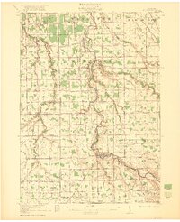
1921 Map of Burt
USGS Topo · Published 1921About this map
The Flint River carves a winding path through this 1919 landscape, serving as a central geographic anchor for the rural communities of southern Saginaw and northern Genesee Counties. This era showcases a transition in transportation, where the Michigan Electric Railway parallels the traditional road network near Birch Run, reflecting the early 20th-century expansion of interurban travel. The sheet is exceptionally dense with rural infrastructure, documenting dozens of family-named schools and churches that served these farming townships.
Find a feature on this map
90 named features on this map. Tap any name to fly to it.
Don’t see what you’re looking for? This feature index may not catch every label — zoom into the map to look around manually.
Map Details
Editions of this 1921 Burt Map
2 editions found
Other maps of this area

1917 · Chesaning
USGS Topo · 1:62,500

1917 · St. Charles
USGS Topo · 1:62,500

1919 · Saginaw
USGS Topo · 1:62,500

1919 · Burt
USGS Topo · 1:62,500

1920 · Flint
USGS Topo · 1:62,500

1920 · Holly
USGS Topo · 1:62,500

1922 · Holly
USGS Topo · 1:62,500

1922 · Durand
USGS Topo · 1:62,500

1922 · Flint
USGS Topo · 1:62,500

1926 · Corunna
USGS Topo · 1:62,500