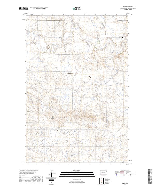
2024 Map of Burt
USGS Topo · Published 2024About this map
The Cannonball River meanders across this Hettinger County landscape, shaping a terrain defined by subtle drainage patterns and the prominent Hogs Back Buttes. This modern survey documents the small settlements of Burt and Watrous, illustrating the persistent rural grid established by the Public Land Survey System. Genealogical interest is centered on the Burt Hope Cem near the river and the Bethany Congregational Cem further south, both serving as quiet markers of the community's ancestral roots. The area remains predominantly agricultural, with a network of section-line roads like Burt Rd and 83rd Ave SW connecting isolated homesteads to the seasonal flows of Spring Creek.
Find a feature on this map
17 named features on this map. Tap any name to fly to it.
Don’t see what you’re looking for? This feature index may not catch every label — zoom into the map to look around manually.
Map Details
Editions of this 2024 Burt Map
This is the sole edition of this map. No revisions or reprints were ever made.
Other maps of this area

1953 · Dickinson
USGS Topo · 1:250,000

1957 · Dickinson
USGS Topo · 1:250,000

1966 · Mott South
USGS Topo · 1:24,000

1966 · Mott North
USGS Topo · 1:24,000

1969 · Burt
USGS Topo · 1:24,000

1969 · North Star Butte
USGS Topo · 1:24,000

1969 · Bentley
USGS Topo · 1:24,000
1969 · Burt NW
USGS Topo · 1:24,000
1974 · Plum Butte NE
USGS Topo · 1:24,000

1974 · Long Butte
USGS Topo · 1:24,000