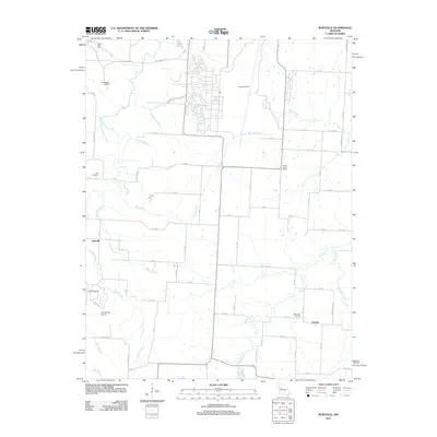
2011 Map of Burtville
USGS Topo · Published 2011About this map
Burtville and Owsley anchor this rural landscape in Johnson County, where a dense network of country roads connects family farms and local institutions. The area is defined by the winding course of the Clear Fork Blackwater River in the northwest and the sprawling drainage of Muddy Creek to the southeast. Local education and community life are marked by the presence of the Prairie Home School and Eldorado School, reflecting the traditional organization of Missouri’s rural townships. The northern portion of the quadrangle features recreational and community landmarks such as Camp Red Cedar, Camp Bob White, and Lake Buteo. Transportation and aviation history are represented by the Lake Sexton Airport and multiple landing strips, while the Ellis Cemetery serves as a significant site for genealogical research in this part of the state.
Find a feature on this map
74 named features on this map. Tap any name to fly to it.
Don’t see what you’re looking for? This feature index may not catch every label — zoom into the map to look around manually.
Map Details
Editions of this 2011 Burtville Map
This is the sole edition of this map. No revisions or reprints were ever made.
Other maps of this area

1885 · Warrensburg
USGS Topo · 1:125,000

1887 · Sedalia
USGS Topo · 1:125,000

1887 · Warrensburg
USGS Topo · 1:125,000

1894 · Sedalia
USGS Topo · 1:125,000

1894 · Warrensburg
USGS Topo · 1:125,000

1917 · Knobnoster
USGS Topo · 1:62,500

1939 · Sweet Springs
USGS Topo · 1:62,500

1940 · Sweet Springs
USGS Topo · 1:62,500

1941 · Sweet Springs
USGS Topo · 1:62,500

1945 · Sweet Springs
USGS Topo · 1:62,500