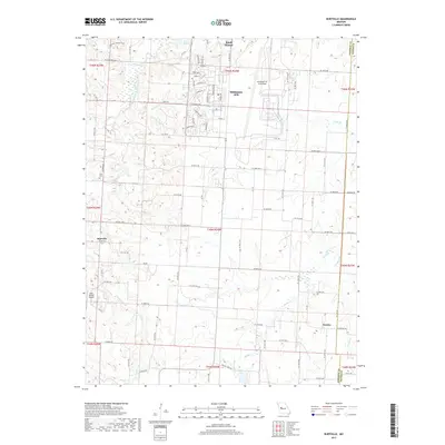
2017 Map of Burtville
USGS Topo · Published 2017About this map
Whiteman Air Force Base occupies a significant portion of this Johnson County landscape, characterized by its specialized infrastructure and housing developments like Carswell and Windsor Drive. Just south of the base, the rural character of the region is defined by the winding course of the East Fork Blackwater River and its numerous tributaries, including McAdoo Creek and Brewer Branch. Small settlements and historic crossroads such as Burtville and Owsley remain focal points for local history, while Ellis Cemetery provides a tangible link to early residents.
Find a feature on this map
102 named features on this map. Tap any name to fly to it.
Don’t see what you’re looking for? This feature index may not catch every label — zoom into the map to look around manually.
Map Details
Editions of this 2017 Burtville Map
This is the sole edition of this map. No revisions or reprints were ever made.
Other maps of this area

1885 · Warrensburg
USGS Topo · 1:125,000

1887 · Sedalia
USGS Topo · 1:125,000

1887 · Warrensburg
USGS Topo · 1:125,000

1894 · Sedalia
USGS Topo · 1:125,000

1894 · Warrensburg
USGS Topo · 1:125,000

1917 · Knobnoster
USGS Topo · 1:62,500

1939 · Sweet Springs
USGS Topo · 1:62,500

1940 · Sweet Springs
USGS Topo · 1:62,500

1941 · Sweet Springs
USGS Topo · 1:62,500

1945 · Sweet Springs
USGS Topo · 1:62,500