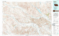
1994 Map of Burwell
USGS Topo · Published 1994About this map
The Middle Loup River and North Loup River define the agricultural and hydrologic character of this Nebraska landscape, where early 1990s land use is deeply tied to water management. Extensive irrigation infrastructure is visible through the Sargent Canal, the Taylor-Ord Canal, and the Milburn Diversion Dam, reflecting the region's reliance on these waterways for farming. To the northeast, the Calamus Reservoir serves as a major landmark, surrounded by the Calamus Reservoir State Wildlife Mgmt Area.
Find a feature on this map
68 named features on this map. Tap any name to fly to it.
Don’t see what you’re looking for? This feature index may not catch every label — zoom into the map to look around manually.
Map Details
Editions of this 1994 Burwell Map
This is the sole edition of this map. No revisions or reprints were ever made.
Other maps of this area

1899 · Loup
USGS Topo · 1:125,000

1948 · Linscott
USGS Topo · 1:62,500

1949 · Koshopah
USGS Topo · 1:62,500

1950 · Linscott
USGS Topo · 1:62,500

1951 · Dunning
USGS Topo · 1:62,500

1951 · Koshopah
USGS Topo · 1:62,500

1951 · Broken Bow NE
USGS Topo · 1:24,000

1951 · Westerville
USGS Topo · 1:24,000

1951 · Lillian
USGS Topo · 1:24,000

1951 · Callaway NW
USGS Topo · 1:24,000