
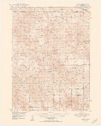
1950 Map of Linscott
USGS Topo · Published 1950About this map
Linscott sits at the northeastern corner of this mid-century survey, which documents a landscape defined by its network of rural educational districts across Custer County and Blaine County. The map reveals a highly decentralized pattern of settlement, where the social infrastructure is anchored by numerous small schoolhouses like Climax Sch, Gallington Sch, and Foote Sch. These sites serve as critical landmarks in an area otherwise characterized by sand-valley topography and intermittent watercourses such as Dry Creek.
Find a feature on this map
16 named features on this map. Tap any name to fly to it.
Don’t see what you’re looking for? This feature index may not catch every label — zoom into the map to look around manually.
Map Details
Editions of this 1950 Linscott Map
2 editions found
Other maps of this area

1948 · Linscott
USGS Topo · 1:62,500

1948 · Halsey
USGS Topo · 1:62,500

1950 · Halsey
USGS Topo · 1:62,500

1951 · Dunning
USGS Topo · 1:62,500

1951 · Hoagland
USGS Topo · 1:62,500

1951 · Callaway NW
USGS Topo · 1:24,000

1951 · Anselmo SW
USGS Topo · 1:24,000

1951 · Anselmo NW
USGS Topo · 1:24,000

1952 · Brewster SW
USGS Topo · 1:24,000

1954 · North Platte
USGS Topo · 1:250,000