
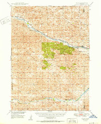
1950 Map of Halsey
USGS Topo · Published 1950About this map
Nebraska National Forest dominates this mid-century landscape, showcasing a massive hand-planted woodland within the Sandhills. The Middle Loup River and Dismal River carve distinct paths through the terrain, with the northern valley serving as a corridor for the Chicago Burlington and Quincy railroad. This transportation link supports the small settlements of Halsey and Natick, which sit at the edge of the forest boundary. Local infrastructure is concentrated near the river, featuring the Nursery and the Scott Lookout Tower, a critical vantage point for forest management. To the north, the terrain transitions into more open ranch land, evidenced by the Rose Hill Sch and the namesake Rose Hill landmark. The map documents a unique intersection of federal forestry efforts and the traditional river-and-rail economy of Thomas and Blaine counties.
Find a feature on this map
13 named features on this map. Tap any name to fly to it.
Don’t see what you’re looking for? This feature index may not catch every label — zoom into the map to look around manually.
Map Details
Editions of this 1950 Halsey Map
2 editions found
Other maps of this area

1948 · Thedford
USGS Topo · 1:62,500

1948 · Linscott
USGS Topo · 1:62,500

1948 · Halsey
USGS Topo · 1:62,500

1948 · Seneca 4
USGS Topo · 1:62,500

1949 · Seneca 4
USGS Topo · 1:62,500

1949 · Purdum
USGS Topo · 1:62,500

1949 · Cody Lake
USGS Topo · 1:62,500

1949 · Koshopah
USGS Topo · 1:62,500

1950 · Linscott
USGS Topo · 1:62,500

1950 · Thedford
USGS Topo · 1:62,500