
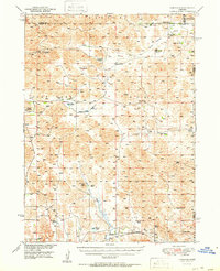
1951 Map of Hoagland
USGS Topo · Published 1951About this map
Hoagland sits at the southern edge of this mid-century survey, a small rail-side community where the South Loup River meets the Union Pacific line. The surrounding landscape of the Sandhills is defined by a sprawling network of family-named ranchlands, including the Halstead Ranch, Marr Ranch, and Miles Ranch. This pattern of settlement reflects the region’s specialized cattle economy during the post-war era, where large holdings were centered around vital water sources like Tarbox Lake and Philpott Lake.
Find a feature on this map
31 named features on this map. Tap any name to fly to it.
Don’t see what you’re looking for? This feature index may not catch every label — zoom into the map to look around manually.
Map Details
Editions of this 1951 Hoagland Map
2 editions found
Other maps of this area

1899 · North Platte
USGS Topo · 1:125,000

1902 · North Platte
USGS Topo · 1:125,000

1948 · Thedford
USGS Topo · 1:62,500

1948 · Linscott
USGS Topo · 1:62,500

1948 · Halsey
USGS Topo · 1:62,500

1949 · Cody Lake
USGS Topo · 1:62,500

1950 · Linscott
USGS Topo · 1:62,500

1950 · Thedford
USGS Topo · 1:62,500

1950 · Halsey
USGS Topo · 1:62,500

1951 · Dunning
USGS Topo · 1:62,500