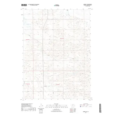
2017 Map of Burwell NE
USGS Topo · Published 2017About this map
Deverre sits in the southwestern portion of this Garfield County landscape, defined by its intricate network of section-line roads and the undulating topography typical of the Nebraska sandhills region. The map reveals a land divided by the Public Land Survey System, specifically across Townships 22 and 23 North, where roads like 832 Rd and 832nd Rd provide access to the rural homesteads of the area. To the north, the terrain transitions toward Beat Flats, a notable hydrological feature that punctuates the otherwise rhythmic rise and fall of the sandy ground. This 2017 survey by the U.S. Geological Survey documents the persistent rural character of the region, where infrastructure is primarily represented by numbered routes such as 840th Rd and 834 Rd, reflecting a landscape dedicated to ranching and open range.
Find a feature on this map
20 named features on this map. Tap any name to fly to it.
Don’t see what you’re looking for? This feature index may not catch every label — zoom into the map to look around manually.
Map Details
Editions of this 2017 Burwell NE Map
This is the sole edition of this map. No revisions or reprints were ever made.
Other maps of this area

1952 · Burwell
USGS Topo · 1:24,000

1952 · Burwell SE
USGS Topo · 1:24,000

1952 · Burwell NE
USGS Topo · 1:24,000

1952 · Burwell NW
USGS Topo · 1:24,000

1954 · Gables SW
USGS Topo · 1:24,000

1954 · Gables NW
USGS Topo · 1:24,000

1955 · Broken Bow
USGS Topo · 1:250,000

1955 · O'Neill
USGS Topo · 1:250,000

1956 · Broken Bow
USGS Topo · 1:250,000

1959 · O'Neill
USGS Topo · 1:250,000