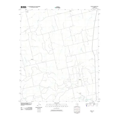
2010 Map of Busby
USGS Topo · Published 2010About this map
The Sweetwater Oil Field serves as a primary industrial landmark in this Texas landscape, anchoring a network of rural roads and county routes. The terrain is defined by a dense system of seasonal waterways, including Kildoogan Creek, East Cottonwood Creek, and Plum Creek, which drain the open ranchland. Small settlements such as Orient, Capitola, Gannon, and Busby are scattered across the quadrangle, connected by farm-to-market roads like FM 57 and FM 419. In the southern portion of the sheet, the presence of Santa Fe Lake and the Sante Fe Depot Rd points to the area's historical transportation and water management infrastructure. Local water sources like Ben Jones Spring further indicate the importance of reliable water points in this semi-arid region of Nolan County.
Find a feature on this map
31 named features on this map. Tap any name to fly to it.
Don’t see what you’re looking for? This feature index may not catch every label — zoom into the map to look around manually.
Map Details
Editions of this 2010 Busby Map
This is the sole edition of this map. No revisions or reprints were ever made.
Other maps of this area

1893 · Roby
USGS Topo · 1:125,000

1893 · Sweetwater
USGS Topo · 1:125,000

1954 · Big Spring
USGS Topo · 1:250,000

1958 · Big Spring
USGS Topo · 1:250,000

1969 · Busby
USGS Topo · 1:24,000

1969 · Bull Creek
USGS Topo · 1:24,000

1969 · Bernecker
USGS Topo · 1:24,000

1969 · Roscoe
USGS Topo · 1:24,000
1969 · Roby
USGS Topo · 1:24,000

1969 · Eskota
USGS Topo · 1:24,000