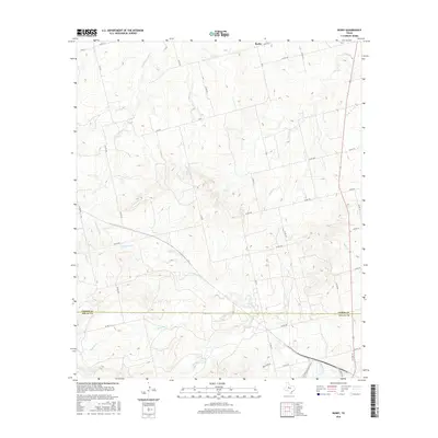
2016 Map of Busby
USGS Topo · Published 2016About this map
Busby lies at the northern edge of this landscape where the high plains of West Texas begin their descent into a network of seasonal drainages. The area is defined by the Fisher Co Nolan Co boundary, a line that cuts across a terrain carved by Kildoogan Creek and Dulaney Creek. This 2016 survey captures a rural environment maintained by a dense grid of county roads, reflecting a long-standing ranching and agricultural framework. To the south, the presence of Ben Jones Spring and Rough Creek suggests the vital importance of water sources in this semi-arid region. The infrastructure includes traces of the area's logistical history, such as Santa Fe Depot Rd, which points to the influence of the railroad on local development and transport near the Nolan County line.
Find a feature on this map
40 named features on this map. Tap any name to fly to it.
Don’t see what you’re looking for? This feature index may not catch every label — zoom into the map to look around manually.
Map Details
Editions of this 2016 Busby Map
This is the sole edition of this map. No revisions or reprints were ever made.
Other maps of this area

1893 · Roby
USGS Topo · 1:125,000

1893 · Sweetwater
USGS Topo · 1:125,000

1954 · Big Spring
USGS Topo · 1:250,000

1958 · Big Spring
USGS Topo · 1:250,000

1969 · Busby
USGS Topo · 1:24,000

1969 · Bull Creek
USGS Topo · 1:24,000

1969 · Bernecker
USGS Topo · 1:24,000

1969 · Roscoe
USGS Topo · 1:24,000
1969 · Roby
USGS Topo · 1:24,000

1969 · Eskota
USGS Topo · 1:24,000