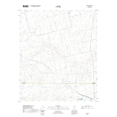
2019 Map of Busby
USGS Topo · Published 2019About this map
Sweetwater anchors the southern edge of this West Texas landscape, where the northern outskirts of the city meet the rolling breaks of the Rolling Plains. The boundary between Fisher Co and Nolan Co bisects the region, dividing a network of county roads and farm-to-market routes that serve the rural community of Busby. Water sources like Ben Jones Spring and the drainage of Dulaney Cr define the local topography, which is marked by a transition from the structured street grid of the city to the expansive ranching and farming terrain to the north.
Find a feature on this map
41 named features on this map. Tap any name to fly to it.
Don’t see what you’re looking for? This feature index may not catch every label — zoom into the map to look around manually.
Map Details
Editions of this 2019 Busby Map
This is the sole edition of this map. No revisions or reprints were ever made.
Other maps of this area

1893 · Roby
USGS Topo · 1:125,000

1893 · Sweetwater
USGS Topo · 1:125,000

1954 · Big Spring
USGS Topo · 1:250,000

1958 · Big Spring
USGS Topo · 1:250,000

1969 · Busby
USGS Topo · 1:24,000

1969 · Bull Creek
USGS Topo · 1:24,000

1969 · Bernecker
USGS Topo · 1:24,000

1969 · Roscoe
USGS Topo · 1:24,000
1969 · Roby
USGS Topo · 1:24,000

1969 · Eskota
USGS Topo · 1:24,000