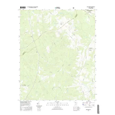
2017 Map of Bush River
USGS Topo · Published 2017About this map
The Sumter National Forest provides a backdrop for this portion of the Piedmont, where the boundary between Laurens and Newberry counties follows the meandering path of the Bush River. This landscape is defined by its watercourses and small rural settlements like Mudlick, centered near the confluence of Mudlick Creek and Mills Creek. For those exploring the area's religious and social history, the presence of the Bush River Quaker Cemetery and Little River Cemetery offers specific points of interest related to early congregational life in the region. The map also documents modern land use and transportation, from the small Sexton Airport to the network of local roads such as Belfast Road and Hopewell Church Road, which connect various family-named ponds and properties including Bedenbaugh Pond Number One and Smiths Pond.
Find a feature on this map
55 named features on this map. Tap any name to fly to it.
Don’t see what you’re looking for? This feature index may not catch every label — zoom into the map to look around manually.
Map Details
Editions of this 2017 Bush River Map
This is the sole edition of this map. No revisions or reprints were ever made.
Other maps of this area

1941 · Spartanburg
USGS Topo · 1:250,000

1953 · Spartanburg
USGS Topo · 1:250,000

1960 · Spartanburg
USGS Topo · 1:250,000

1963 · Spartanburg
USGS Topo · 1:250,000

1964 · Spartanburg
USGS Topo · 1:250,000

1969 · Newberry NW
USGS Topo · 1:24,000

1969 · Newberry West
USGS Topo · 1:24,000
1970 · Bush River
USGS Topo · 1:24,000
1970 · Cross Hill
USGS Topo · 1:24,000
1971 · Joanna
USGS Topo · 1:24,000