
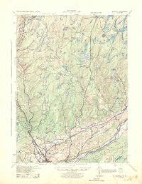
1943 Map of Bushkill
USGS Topo · Published 1943About this map
The Delaware River defines the southeastern corridor of this 1943 War Department survey, where river crossings like Dimicks Ferry linked Pennsylvania and New Jersey. The landscape is characterized by a dense network of upland water bodies such as Twelvemile Pond and Mud Pond, alongside designated tracts like Hunters Range and Forest Park. Settlement patterns show small clusters at Marshalls Creek, Shoemakers, and Bushkill, with rural life anchored by institutions like the St Thomas Chapel and a series of district schools including Livingston Sch and Brushy Mountain Sch. Engineering of the era is evident at the Beaver Run Dam and the infrastructure serving the Delaware valley. The transition from the alluvial flats of Shawnee Island to the heights of Kittatinny Mountain provides a detailed record of Monroe County’s geography before modern development shifted the region's character.
Find a feature on this map
40 named features on this map. Tap any name to fly to it.
Don’t see what you’re looking for? This feature index may not catch every label — zoom into the map to look around manually.
Map Details
Editions of this 1943 Bushkill Map
2 editions found
Other maps of this area

1888 · Hackettstown
USGS Topo · 1:62,500

1891 · Wallpack
USGS Topo · 1:62,500

1891 · Delaware Water Gap
USGS Topo · 1:62,500

1893 · Delaware Water Gap
USGS Topo · 1:62,500

1893 · Wallpack
USGS Topo · 1:62,500

1894 · Hackettstown
USGS Topo · 1:62,500

1898 · Hackettstown
USGS Topo · 1:62,500

1900 · Raritan
USGS Topo · 1:125,000

1905 · Raritan
USGS Topo · 1:125,000

1905 · Hackettstown
USGS Topo · 1:62,500
Featured Places
- Blairstown, NJ
- Hardwick Township, NJ
- Lehman Township, PA
- Saw Creek, Lehman Township
- Delaware Township, PA