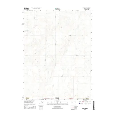
2014 Map of Bushnell SE
USGS Topo · Published 2014About this map
The Pawnee National Grassland dominates the southern portion of this high plains landscape, where the borders of Nebraska and Colorado intersect. This 2014 survey captures a sparsely populated transition zone between the two states, defined by a rigid grid of county roads such as Co Road 23 and Co Road 25. The terrain is characterized by subtle topographic shifts and drainage patterns typical of the region, punctuated by human-made water management features like the School Lands Reservoir. The map illustrates the administrative divisions of Kimball and Weld counties, highlighting how the section-line road system facilitates agricultural and conservation land use in this open grassland environment.
Find a feature on this map
14 named features on this map. Tap any name to fly to it.
Don’t see what you’re looking for? This feature index may not catch every label — zoom into the map to look around manually.
Map Details
Editions of this 2014 Bushnell SE Map
This is the sole edition of this map. No revisions or reprints were ever made.
Other maps of this area

1954 · Sterling
USGS Topo · 1:250,000

1954 · Scottsbluff
USGS Topo · 1:250,000

1958 · Scottsbluff
USGS Topo · 1:250,000

1958 · Sterling
USGS Topo · 1:250,000
1972 · Bushnell SW
USGS Topo · 1:24,000

1972 · Kimball SW
USGS Topo · 1:24,000

1972 · Bushnell
USGS Topo · 1:24,000

1972 · Kimball
USGS Topo · 1:24,000

1972 · Bushnell SE
USGS Topo · 1:24,000

1972 · Oliver Reservoir
USGS Topo · 1:24,000