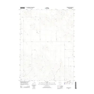
2014 Map of Buske Ranch
USGS Topo · Published 2014About this map
Buske Ranch sits within a landscape defined by the expansive cattle-ranching traditions of Garden County. This 2014 survey documents a vast section of Nebraska’s high plains, where the terrain is lightly marked by intermittent water sources like Coldwater Cr. In the southern reaches of the map, the Lisco Canal indicates the importance of managed water systems for agriculture in this arid environment. The map shows a meticulous grid of rural roads, including Road 80 and Road 155, which serve as the primary lifelines for the remote ranching operations. The sparsity of the built environment emphasizes the massive scale of individual land holdings in this part of the Sandhills, where human presence is clustered around the central ranch and the essential irrigation infrastructure to the south.
Find a feature on this map
16 named features on this map. Tap any name to fly to it.
Don’t see what you’re looking for? This feature index may not catch every label — zoom into the map to look around manually.
Map Details
Editions of this 2014 Buske Ranch Map
This is the sole edition of this map. No revisions or reprints were ever made.
Other maps of this area

1896 · Browns Creek
USGS Topo · 1:125,000

1899 · Browns Creek
USGS Topo · 1:125,000

1899 · Sidney
USGS Topo · 1:125,000

1900 · Chappell
USGS Topo · 1:125,000

1950 · Crescent Lake
USGS Topo · 1:62,500

1954 · Scottsbluff
USGS Topo · 1:250,000

1958 · Scottsbluff
USGS Topo · 1:250,000

1971 · Richardson Lake
USGS Topo · 1:24,000

1971 · Coumbe Bluff
USGS Topo · 1:24,000

1971 · Tar Valley SW
USGS Topo · 1:24,000