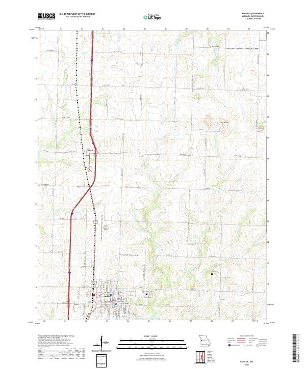
2021 Map of Butler
USGS Topo · Published 2021About this map
The Bates County Courthouse serves as the civic anchor for Butler, a community defined by its grid of residential streets and proximity to the north-south corridor of Route 71. This modern survey illustrates the town's expansion toward Kennedy Lake and the Butler Recreational Lake, showing a landscape where agricultural utility meets civic infrastructure. To the north, the small settlement of Passaic sits along the highway, surrounded by the winding courses of Bones Br and Big Deer Cr. The terrain is punctuated by distinctive elevations such as Long Mound and Round Mound, while family and community history is preserved at Oak Hill Cem, Glass Cem, and Nichols Cem. The presence of the Butler Memorial Airport underscores the area's role as a regional hub in western Missouri.
Find a feature on this map
70 named features on this map. Tap any name to fly to it.
Don’t see what you’re looking for? This feature index may not catch every label — zoom into the map to look around manually.
Map Details
Editions of this 2021 Butler Map
This is the sole edition of this map. No revisions or reprints were ever made.
Other maps of this area

1887 · Butler
USGS Topo · 1:125,000

1894 · Butler
USGS Topo · 1:125,000

1937 · New Home
USGS Topo · 1:24,000

1947 · Lawrence
USGS Topo · 1:250,000

1950 · Lawrence
USGS Topo · 1:250,000

1956 · Lawrence
USGS Topo · 1:250,000

1961 · Lawrence
USGS Topo · 1:250,000
1961 · Pleasant Gap
USGS Topo · 1:24,000
1961 · Main City
USGS Topo · 1:24,000
1961 · Butler
USGS Topo · 1:24,000