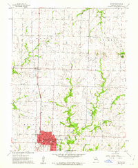
1961 Map of Butler
USGS Topo · Published 1962About this map
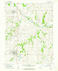
Butler serves as the regional hub for this western Missouri landscape, centered on its courthouse and town square with a detailed street grid including Ohio St and Broadway. The Missouri Pacific railroad cuts a straight north-south line through the territory, passing the small settlement of Passaic and the nearby County Farm. This era shows a community expanding its infrastructure, evidenced by the Butler Airport, the Waterworks, and the Butler Recreational Lake at the southern edge of town.
Find a feature on this map
39 named features on this map. Tap any name to fly to it.
Don’t see what you’re looking for? This feature index may not catch every label — zoom into the map to look around manually.
Map Details
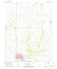
Editions of this 1961 Butler Map
2 editions found
Other maps of this area

1887 · Butler
USGS Topo · 1:125,000

1894 · Butler
USGS Topo · 1:125,000
1937 · New Home
USGS Topo · 1:24,000

1947 · Lawrence
USGS Topo · 1:250,000

1950 · Lawrence
USGS Topo · 1:250,000

1956 · Lawrence
USGS Topo · 1:250,000

1961 · Lawrence
USGS Topo · 1:250,000
1961 · Pleasant Gap
USGS Topo · 1:24,000
1961 · Main City
USGS Topo · 1:24,000
1961 · Adrian
USGS Topo · 1:24,000