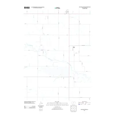
2013 Map of Butler Center
USGS Topo · Published 2013About this map
The meandering W Fork Cedar River serves as the central geographic axis for this portion of Butler County, Iowa. The landscape is defined by the rigid grid of rural section roads, including Butler Center Rd and Ivy Ave, which carve through the fertile terrain. The small community of Butler Center sits near the eastern edge of the survey, a quiet node in an area otherwise dominated by agriculture. To the north, the Butler County Fairgrounds indicates a local hub of community gathering and regional tradition. Water management is a visible priority across the sheet, with Kilson Cr, Johnson Cr, and McClure Cr draining the fields into the larger river system. A historical crossing point is preserved at Mead Bridge, providing a specific location for those tracing the development of local infrastructure and travel routes during the early 21st century.
Find a feature on this map
36 named features on this map. Tap any name to fly to it.
Don’t see what you’re looking for? This feature index may not catch every label — zoom into the map to look around manually.
Map Details
Editions of this 2013 Butler Center Map
This is the sole edition of this map. No revisions or reprints were ever made.
Other maps of this area

1954 · Waterloo
USGS Topo · 1:250,000

1955 · Waterloo
USGS Topo · 1:250,000

1971 · Coster
USGS Topo · 1:24,000

1971 · Clarksville
USGS Topo · 1:24,000

1971 · Stout
USGS Topo · 1:24,000

1972 · Dumont North
USGS Topo · 1:24,000

1972 · Allison
USGS Topo · 1:24,000

1979 · Dumont South
USGS Topo · 1:24,000

1979 · Butler Center
USGS Topo · 1:24,000

1980 · Aplington
USGS Topo · 1:24,000